Northeast Iowa hit with floods
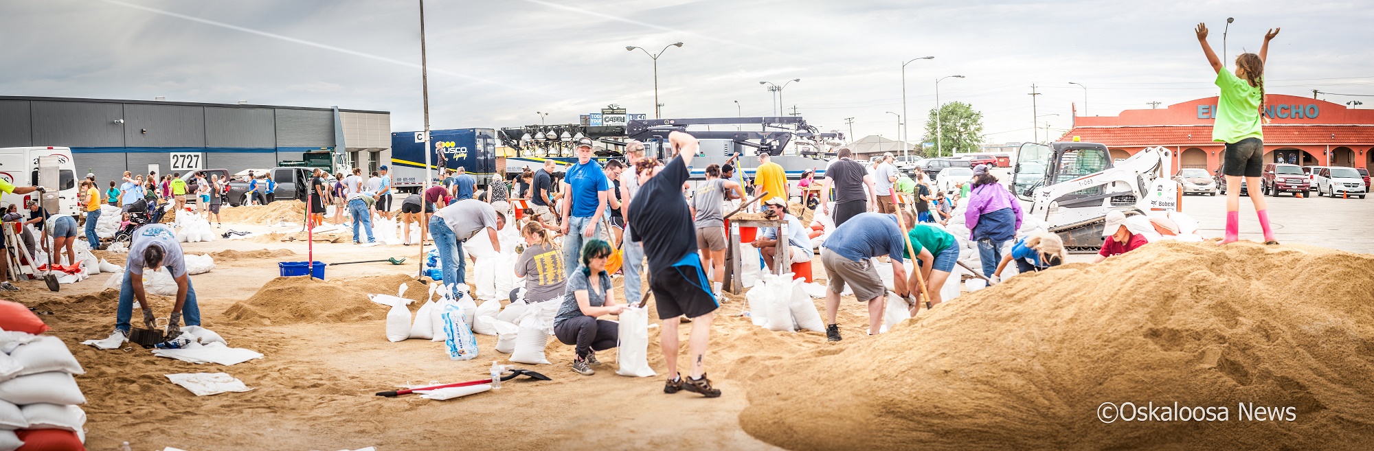
A Musco light truck sits in the background preparing to light up the night as sandbagging efforts were underway in Cedar Rapids.
Many crests below 2008 records
CEDAR RAPIDS- For the second time in less than 10 years, Cedar Rapids is under the gun for significant flooding. As a result of heavy rains last week and previously saturated ground, the Cedar River has been pushed out of its banks, forcing the evacuation of numerous residents along the Cedar River.
In Cedar Rapids, current forecasts call for the river to crest at 23 feet, well about the flood stage of 12 feet, but also well below the record of 31.12 feet set during the Floods of 2008. If the forecasts hold true, the river should crest at around 11 a.m. on Tuesday. At the current forecasted level, numerous residences and businesses near the river will receive water, including within the Czech Village, which was hit hard in 2008.
According to the City of Cedar Rapids city website, evacuation orders were given on Sunday, although residents were not required to leave the evacuation zone. In addition, a curfew within the evacuation zone of 8 p.m. to 7 a.m. is in place and being enforced until further notice. Despite flood improvements made since the 2008 floods, city officials are holding their breaths.
“Efforts have been made throughout the community for flood protection on both sides of the river. Public Works crews and contractors have continued to work around the clock on flood control efforts. The City would like to thank the public for their assistance in avoiding the downtown and surrounding areas, as this has opened access for construction and emergency vehicle,” says a statement on the city website.
Volunteers have been helping bag sandbags around the clock since Sunday, with Musco trucks being sent to the area to help assist with the sandbagging efforts.
Further upstream in Waterloo/Cedar Falls, the worst appears to be over. Waterloo and Cedar Falls both saw significant crests, with the Cedar River cresting in both locations at levels that were the second highest on record, behind the 2008 floods. Both locations saw river crests on Saturday and have been steadily lowering since then.
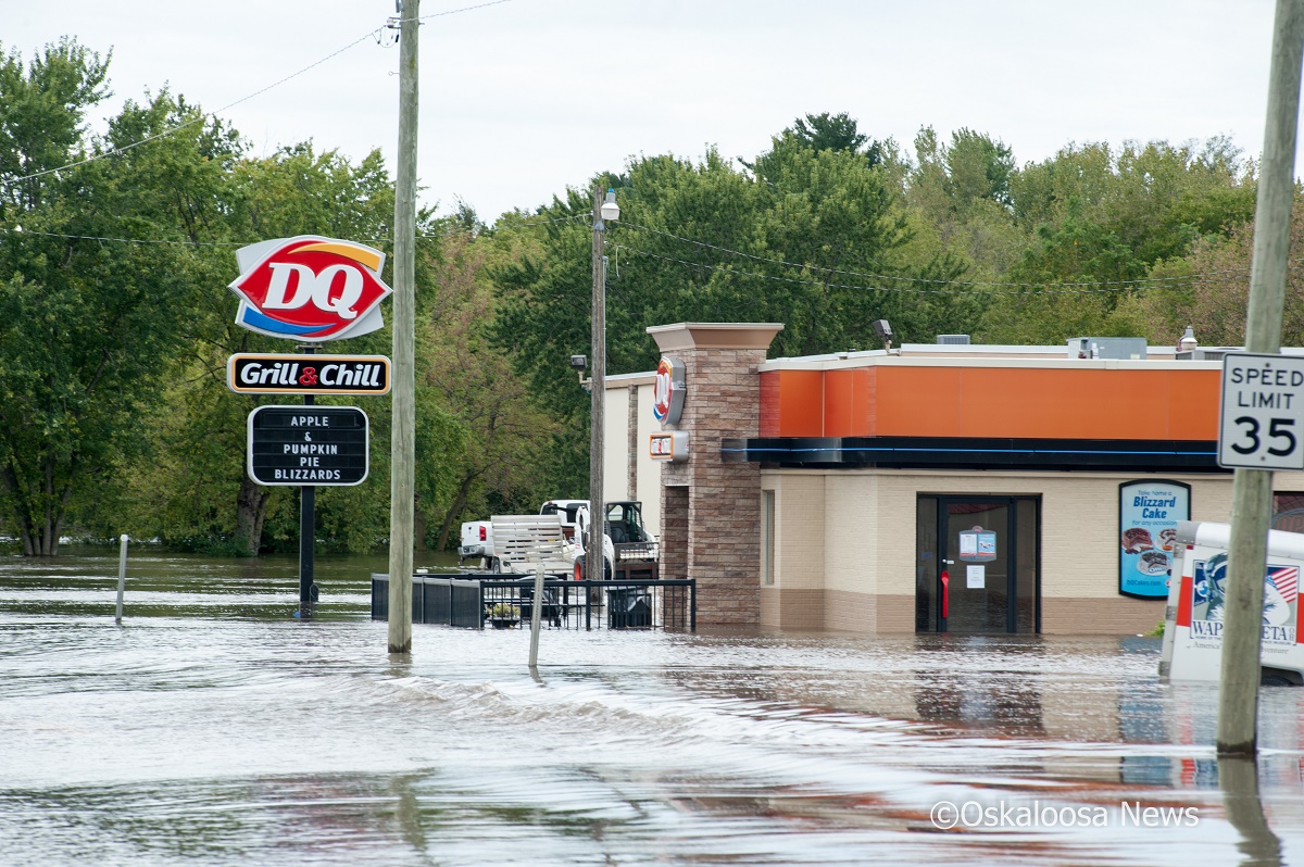
Some businesses in Independence, Iowa suffered flood related damages as area rivers spilled over their banks.
To the east along the Wapsipnicon River, Independence saw flood levels rise to major stage. Levels in Independence crested Sunday morning at 19.36 feet, below the record of 22.4 feet, set during the 1999 floods in Northern Iowa. Damage in Independence was kept to a minimum as a result of flood protection projects that were completed after the 1999 flood, according to Buchanan County Sheriff Bill Wolfgram.
“We’ve learned a lot and gained a lot of experience from that [the 1999 flood],” Wolfgram said.
Water did creep up along the backs of some businesses in the downtown area as well as cause basement flooding in homes closest to the river. Several parks along the river were also flooded out.
Flooding over Highway 150 in the Independence area did force the closure of a portion of the highway on the south side of Independence, including the Highway 150 Bridge. The bridge was closed by the DOT early Sunday morning and had been opened back up by Monday morning.
River levels throughout most of northeast Iowa are expected to be back below flood stages by the end of the week.