Iowa becomes a State December 28
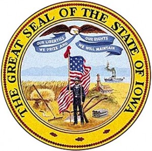
“Our liberties we prize and our rights we will maintain.”
But what was Iowa, and for that matter Mahaska County and Oskaloosa before the time she was a State?
Some of the first European’s to map and explore the area that contains Iowa was Jacques Marquette and Louis Jolliet. These men traveled the Mississippi River in 1673 documenting villages along that route. They claimed the area for France, and it remained under French control until 1763 when, knowing that defeat was coming, they transferred the land to their ally Spain.
The Spanish held very loose control over the area and the trading posts along the Mississippi River and Des Moines River.
Iowa was a part of the territory known as La Louisiane or Louisiana when most Europeans were interested in the furs obtained from the territory. The Sauk and Meskwaki controlled trade on the Mississippi River during this time. Early traders on the Mississippi River were Julien Dubuque, Robert La Salle, and Paul Marin, many of those names are now familiar geographic locations on our maps.
In 1800, Napoleon Bonaparte took control of Louisiana from Spain in a treaty. The United States bought the area from France that contains Iowa in the Louisiana Purchase of 1803. 828,800 square miles was purchased for 15 million dollars by President Thomas Jefferson. The territory purchased contains either part of or all of these present day states: Arkansas, Missouri, Iowa, Oklahoma, Kansas, Nebraska, Minnesota, North Dakota, South Dakota, New Mexico, Montana, Wyoming, Colorado and Louisiana.
Fort Madison was built in 1808 and was a military fortress laying United States claim to the territory. The fort was hated and attacked by Sauk and other tribes until it’s defeat in the War of 1812 by British supported Sauk Indians along with Black Hawk taking part in the siege of Fort Madison.
After the war of 1812, the United States encouraged settlement of area’s East of the Mississippi River, and the removal of Indians to the West of the Mississippi River. An 1804 treaty that had surrendered much of Illinois to the US helped to enrage the Sauk and with previous events helped to lead to the Black Hawk War of 1832.
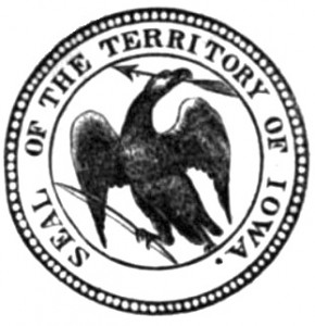
Officially, the first settlers arrived to Iowa in June 1833 and on July 4, 1838, the U.S. Congress established the Territory of Iowa. President Martin Van Buren appointed Robert Lucas the first governor of the territory. The territory then had 22 counties and 23,242 people, with the territory’s capitol being Burlington until 1841 when it was moved to Iowa City.
A constitution had to be written and accepted. Not only was a constitution needed, but the boundaries needed to be agreed upon as well. You can read Iowa’s Constitution HERE. http://www.legis.state.ia.us/Constitution.html
Finally on December 28, 1846 Iowa became the 29th State to enter the Union when President James K. Polk signed Iowa’s admission bill into law, settling Iowa’s borders in the bill.
The capitol remained in Iowa City until 1849 when it was then moved to Des Moines.
Mahaska County was formed February 17, 1843 and was the first county to have a sheriff and a justice of the peace. Mahaska County took it’s name after Chief Mahaska of the Iowa Tribe.
Oskaloosa was formally platted in 1844 and became the Mahaska County seat that year.


