The Map To Safety For A Hypothetical Crisis

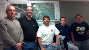
From left to right: Bill Felkner, Scott Augsburger, Don Hubbard, Jake McCoy, Katie Miller (submitted photo)
Oskaloosa, Iowa – It would be a disaster of tragic proportions if it were to ever take place, but with planning in place the loss of life could be held to a minimum.
Students from Indian Hills Community College Geo-spatial Technology class worked with the Army Corps of Engineers at Red Rock. The group made six maps utilizing data from the Corps of Engineers, Mahaska County GIS Coordinator Brian Knudtson, along with data from the Iowa Geological Survey of the Iowa Dept of Natural Resources.
The purpose of the maps was to help better prepare for a hypothetical failure at the Red Rock Dam. Wanting to tackle a major project, the class saw this as a way to demonstrate the skills they have gained.
The group then presented the finished maps to Mahaska County Emergency Manager Jamey Robinson. Robinson will store the information in the event that the hypothetical ever became a reality, making the work the students performed a possible lifesaving project in the end.
One portion of the group, composing of Bill Felkner and Scott Augsburger, spent nearly 15 hours on data collection, analysis, buffer zones and layout, with another portion of the group, consisting of Katie Miller and Jake McCoy, doing additional data analysis, tables and Actual Point shape-files. Each of those team members added approximately 4 additional hours each.
Project Leader Don Hubbard also worked on the data analysis, besides handling the organization, layout and design. He contributed nearly 30 hours of time during the project.
Class Instructor for the project was Brian Knudtson, who is also Mahaska County’s GIS Coordinator.
“I would like to thank Jamie [Robinson] and Brian [Knudtson] for the opportunity to do this project, the team (classmates) have done an awesome job. This project has taught me a lot and I’ll use everything I’ve learned to sharpen my skills as I continue with the Geospatial Technology program at Indian Hills Community College, and seek a career after graduation.”
GIS student Katie Miller said of working on the project, “It was an honor to work on this project.”
More about GIS from the Mahaska County Website, “The Geographic Information System (GIS) Department was created in July 1999 to serve the GIS needs of Mahaska County.”
“GIS is used by several county departments, such as the Assessor, Auditor, Engineer, and Environmental Services. The GIS Department maintains equipment, software and data, and produces hard-copy maps to support the use of GIS by county agencies.”
About Geo-spatial Technology at Indian Hills Community College.
Geo-spatial Technology is offered through Indian Hills Community College. It is an evening course that offers an Associates Degree in 6 terms (1 1/2 years). Our instructors work in the industry so they are very knowledgeable with what GIS can offer. If you’re looking for a challenging and rewarding career start here. Geo-spatial Technology is currently the third fastest growing industry right now.
Some of the different technologies and spatial data used in Geo-spatial Technology is GIS (Geographic Information Systems), GPS (Global Positioning Systems), databases, census and remote sensing. There are a variety of careers that a person can get into after completion of the program. Contact the Indian Hills Community College for more information.


